Ad

Ad

Progress for group 0 ad

Daniel Metaferiya(updated)
Addis Ababa, Ethiopia
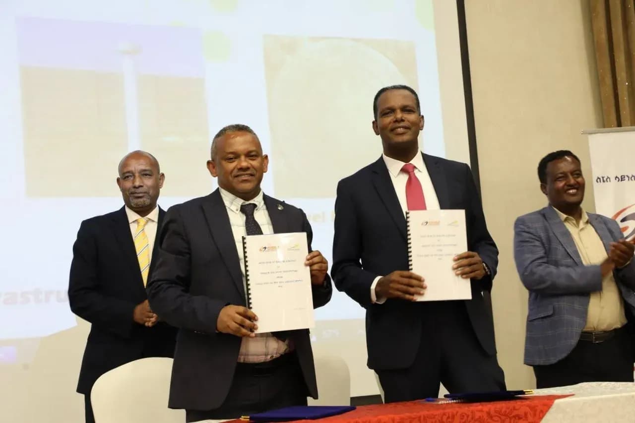
The Space Science and Geospatial Institute has partnered with National Airways, a private airline based in Addis Ababa, to capture aerial images using local planes, saving millions of birr annually.
The agreement, signed last week by Abdisa Yilma, Director General of the Space Science and Geospatial Institute, and Captain Abera Lemi, CEO of National Airways, will replace the previous reliance on rented planes from abroad.
Aerial photography, one of the earliest and most cost-effective forms of remote sensing, remains widely used. Abdisa noted that the cameras installed on the planes produce high-quality images for various purposes. He added that the previous method required foreign currency, creating challenges for the office. The new agreement is a significant step toward resolving this issue.
Kemahu Abraham, Lead Executive of Aerial Surveying at the Institute, stated that Ethiopia’s aerial surveying operations cost between 100 and 150 million birr annually. Previously, the Institute rented planes from abroad, costing $2200 to $2500 per hour, depending on resolution, accuracy level, and area requirements.
The new agreement is expected to save $250,000 to $350,000 per year. “We can collect two types of data using two planes rented from National Airways,” said Kemahu.
“One type is photographic images captured with state-of-the-art camera systems, each weighing around 100 kg and costing about $1.2 million. These cameras will be installed on two National Airways planes using an adapter plate and a gyroscope, which maintains orientation and reduces blurring due to turbulence and other factors.”
The other essential component in aerial imaging is GPS, which assists operators and pilots in navigating to the project area and taking photos automatically. GPS also provides X, Y, and Z coordinates for all photos.
The second type of data recorded by the planes is LiDAR data. “LiDAR functions similarly to aerial photography, with comparable components. However, instead of images, LiDAR captures topographic data showing the earth’s structure. Both data types are highly accurate and detailed compared to other geospatial data,” Kemahu told Shega.
The Aerial Surveying Executive states that aerial survey data is highly accurate, has a high resolution, and is less expensive than satellite images. Previously, only foreign-funded projects utilized this data, but with payments now in local currency, it is accessible to all local users.
Since 2011, more than 450,000 km² of Ethiopia has been covered with aerial survey data, Kemahu noted. “Additionally, we have completed a small project in South Sudan,” he added.
Share this post:
At Shega, we do more than tell stories. We help you make an impact. Our platforms, data, and expertise connect brands, organizations, and investors to the audiences and insights that matter.
Reach, engage, and grow with us.
Get in Touch
Undercurrents of USAID Funding Freeze in Ethiopia
01 March 2025

ECMA Opens Door to Capital Market Innovation with Launch of Sandbox1
24 November 2024

Ethiopia’s Delicate Dance with Personal Data Protection
24 August 2024
Latest Stories
03 July 2026
QA on july 3 What does it take for technology in education to actually work for everyone? this Post on QA
By Chilen22 December 2025
𝗗𝗲𝘀𝗶𝗴𝗻𝗲𝗱 𝗳𝗼𝗿 𝗪𝗵𝗼𝗺? 𝗧𝗵𝗲 𝗠𝗶𝗿𝗮𝗴𝗲 𝗼𝗳 𝗪𝗼𝗺𝗲𝗻-𝗖𝗲𝗻𝘁𝗿𝗶𝗰 𝗗𝗶𝗴𝗶𝘁𝗮𝗹 𝗙𝗶𝗻𝗮𝗻𝗰𝗲 𝗶𝗻 𝗘𝘁𝗵𝗶𝗼𝗽𝗶𝗮 QA
By ChilenLatest Stories
QA on july 3 What does it take for technology in education to actually work for everyone? this Post on QA
03 July 2026

𝗗𝗲𝘀𝗶𝗴𝗻𝗲𝗱 𝗳𝗼𝗿 𝗪𝗵𝗼𝗺? 𝗧𝗵𝗲 𝗠𝗶𝗿𝗮𝗴𝗲 𝗼𝗳 𝗪𝗼𝗺𝗲𝗻-𝗖𝗲𝗻𝘁𝗿𝗶𝗰 𝗗𝗶𝗴𝗶𝘁𝗮𝗹 𝗙𝗶𝗻𝗮𝗻𝗰𝗲 𝗶𝗻 𝗘𝘁𝗵𝗶𝗼𝗽𝗶𝗮 QA
22 December 2025

Undercurrents of USAID Funding Freeze in Ethiopia
01 March 2025
ECMA Opens Door to Capital Market Innovation with Launch of Sandbox1
24 November 2024
Ethiopia’s Delicate Dance with Personal Data Protection
24 August 2024